
The Palisades of the Hudson River are a great place to hike. But most loop hikes along the Palisades involve hiking down to the river and then climbing up again. One exception is this loop hike to the south of the State Line Lookout. This 3-mile easy to moderate hike does involve a descent and then a climb of stone steps toward its end, but the rest of the hike is level, or nearly so. The hike can be completed in two hours, but it might take you a little longer if you spend some time at the viewpoints along the way.
To reach the trailhead, take the Palisades Interstate Parkway north from the George Washington Bridge. Continue for 1.7 miles beyond Exit 2, and turn right at a sign for the State Line Lookout. Follow the access road for about half a mile until it ends at a large parking lot near the lookout. (If you are coming from the north on the Parkway, bear left just beyond Exit 3 and follow the signs for the lookout.)
The hike begins at the northwest corner of the State Line Lookout parking area, at a sign for the Long Path. Follow the wide path into the woods. You’ll soon reach a junction where the Long Path turns left and Trail A comes in from the left and proceeds ahead. Continue ahead on the wide path. Just beyond, you’ll come to another junction. Here, Trail C begins on the right, but you should continue ahead on Trail A. About five minutes into the hike you’ll reach a third junction, marked by an old rock monument on the left (the faded words “Shore Path” may be visible on the back side of the monument). Trail A turns left here, but you should continue ahead on Trail B, which begins to climb.
After approaching the Parkway, Trail B curves to the left. Soon, with the access road to State Line Lookout visible ahead, a branch of Trail B goes off to the left, but you should continue ahead to the paved access road. Cross the road and turn right along its shoulder for 400 feet. Just beyond a “Do Not Enter” sign there is a break in the stone guardrail. Turn left here and descend on an unmarked trail, which climbs a little and bears left, crosses a wooden footbridge and begins to parallel the Parkway.
After turning left, away from the Parkway, the unmarked trail ends at a woods road just east of the Parkway. Turn left onto this road, and just ahead you’ll reach a junction with the blue/white-blazed Forest View Trail. To the right, this trail crosses a footbridge over the Parkway, but you should proceed ahead (east) on the trail, which follows a wide woods road. At the next junction, turn right on another road—the route of the aqua-blazed Long Path—and continue to follow the Long Path when, in about 500 feet, it turns left onto another woods road.
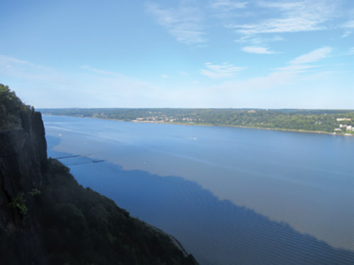
In another 0.3 mile, the Long Path curves to the left and begins to approach the cliff edge. When it curves to the right near the cliff edge, continue ahead on a footpath that leads toward a concrete-block wall. Just to the right of the wall is a spectacular viewpoint, known as Ruckman Point. This overlook—situated 520 feet above the Hudson River below—offers panoramic views up and down the river. The abandoned pilings in the river to the north are the remains of the former Forest View marina.
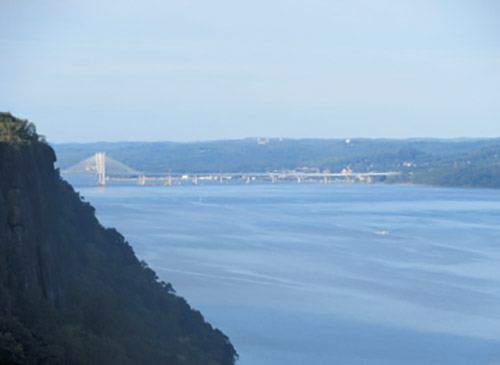
When you’re ready to continue, go back to the Long Path and head west, retracing your steps for about 200 feet, then turn right onto an unmarked footpath (before reaching a concrete culvert). Follow this trail for about 0.2 mile along a section of cliff that has split from the main face of the Palisades, with a steep ravine on the left. At the end of the trail there is another panoramic viewpoint from which you can see north as far as the Tappan Zee Bridge.
Now retrace your steps, returning to the Long Path, and turn right, crossing a concrete culvert over a stream. About 100 feet beyond the culvert you’ll see a large fallen tree on the right. Just beyond (before reaching another fallen tree with smaller branches), turn right and follow another unmarked trail that heads north, parallel to but on the other side of the ravine. Soon after reaching the end of the isolated cliff section on the right, you’ll approach another ravine. Here, a side trail leads right to another panoramic viewpoint.
Continue ahead on the unmarked trail, with an interesting shallow ravine on the left. Soon, another side trail on the right leads to a viewpoint with a bench. In the spring, daffodils and periwinkles bloom in this area. Beyond the viewpoint, the trail passes through the former estate of John and Cora Burnett, which was taken by eminent domain in the 1950s to enable the construction of the Palisades Interstate Parkway. You’ll notice on the left a number of exotic plants and the remnants of their swimming pool.
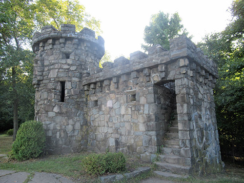
After widening into a woods road, the unmarked trail ends at an intersection with the blue/white-blazed Forest View Trail and the aqua-blazed Long Path. Turn right and follow these trails, which lead to the Women’s Federation Monument: a small stone “castle” that commemorates the efforts of the New Jersey Federation of Women’s Clubs to preserve the Palisades in the early 20th century.
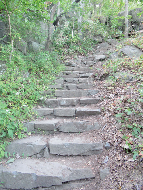
Continue to follow the aqua-blue/white blazes, which descend steadily on rock steps to a T-intersection. Here, the Forest View Trail turns right, but you should turn left, following the aqua Long Path blazes, which cross a footbridge over a stream and climb rather steeply on rock steps. At the top of the climb, follow the Long Path as it crosses the access road to State Line Lookout and re-enters the woods. A short distance ahead, the Long Path turns right onto Trail A. Continue along the Long Path/Trail A, which passes a vernal pond and returns to the parking area where the hike began.
By Daniel D. Chazin
This hiking article is provided by Daniel Chazin of the New York-New Jersey Trail Conference. The Trail Conference is a volunteer organization that builds and maintains over 2,000 miles of hiking trails and publishes a library of hiking maps and books, including a five-map set for Hudson Palisades Trails ($9.95). The Trail Conference’s office is at 600 Ramapo Valley Road (Route 202), Mahwah; (201) 512-9348; www.nynjtc.org. Daniel Chazin can be reached at [email protected].


