
For Chol Hamoed Sukkot, you might want to try a hike that’s a little farther away from home. This 6.5-mile hike, which takes about four hours, is in High Point State Park in northwestern New Jersey. It should take about an hour and a half to get there. The hike is rated as moderate, since you’ll have to negotiate a few steep climbs towards the start, but the last half of the hike follows a relatively level woods road. There are some great views from viewpoints along the Appalachian Trail, which you’ll follow for the first part of the hike, and the last part of the hike passes the secluded Lake Rutherford.
As the name of the park indicates, the highest point in New Jersey (1,803 feet), marked by a stone monument, is found here. Although this hike doesn’t reach this high point, it does climb to elevations that exceed 1,600 feet above sea level. (If you’d like, you can visit the High Point Monument after you’ve finished the hike.)
To reach the trailhead, take N.J. Route 4 West to N.J. Route 208. At the end of N.J. Route 208, continue onto I-287 South (although High Point State Park is further north, be sure to take I-287 South). Take Exit 52A/B, bear right at the fork, and continue on N.J. Route 23 North for about 35 miles. As you begin the final steep climb to High Point, County Route 519 (Greenville Road) goes off to the right. Continue along Route 23 for another 0.6 mile. Just beyond stone pillars on both sides of the road, turn left at a sign for “Appalachian Trail Parking.” Proceed for 0.1 mile and park in the large parking area.
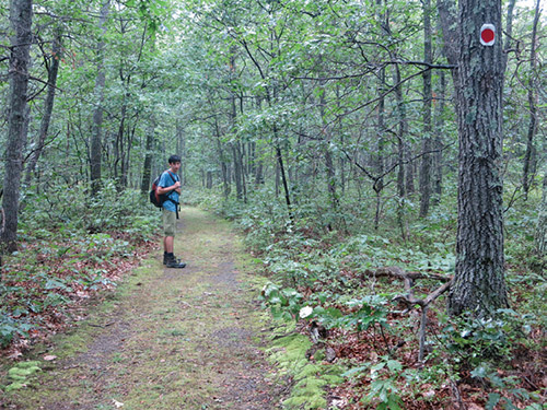
The hike starts at a kiosk at the southwest comer of the parking area. You begin by following a blue-blazed trail gently uphill. In 0.2 miles, the blue-blazed trail joins the red-dot-on-white-blazed Iris Trail. Turn right and follow the joint blue/red trail a short distance to a four-way junction, with a four-foot-high pipe on the left. Here, the red-on-white-blazed Iris Trail turns right, and the yellow-on-white-blazed Mashipacong Trail continues ahead. You should turn left onto the white-blazed Appalachian Trail (A.T.), which you’ll be following for the next 3.3 miles.
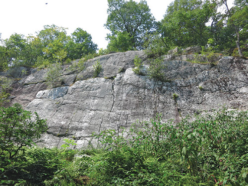
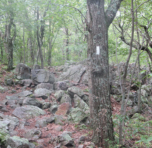
After passing an interesting cliff on the right, the A.T. continues ahead on an old woods road. Soon, it bears right and begins to climb to the ridge of Kittatinny Mountain. It reaches a rocky summit and continues along the ridge, with many jagged rocks along the footpath.
About a mile from the start, the Blue Dot Trail leads to the right (it leads down to Sawmill Lake). Continue ahead on the A.T. A short distance beyond, you’ll reach a west-facing viewpoint, with Sawmill Lake visible below. The trail now turns left and descends on a rocky footpath to a valley between the two ridges of the mountain. It then climbs very steeply to the eastern ridge. At the top of the climb, there are views to the right of the western ridge. After continuing to the eastern side of the ridge, you’ll reach another viewpoint (elevation 1,622 feet)—this one, facing east, is largely obscured by vegetation. The trail continues south along the ridge, descending gradually.
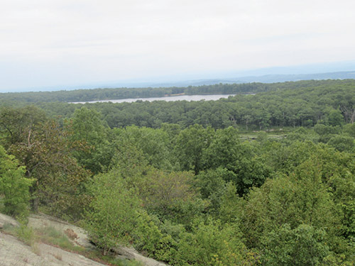
In another mile along the ridge, you’ll come out on a panoramic east-facing viewpoint from open rocks to the left of the trail. Lake Rutherford, which you’ll be visiting on your return trip, is visible to the left, and the rural Wallkill Valley is beyond. You’ll immediately pass another viewpoint, after which the trail goes back into the woods. In another 0.2 miles, you’ll reach another east-facing viewpoint from open rocks on the left. This viewpoint, known as Dutch Shoe Rock, offers a broad view over the Wallkill Valley, but Lake Rutherford is not visible.
The trail now bears left and begins to descend. At the base of the descent, a blue-blazed side trail on the left leads 0.4 miles to the Rutherford Shelter—a wooden shelter with a nearby spring, where overnight camping is permitted. A side hike to the shelter and back will add about half an hour to your hike.
After climbing a little and turning sharply right, you’ll reach a junction with the red-dot-on-white-blazed Iris Trail. Turn left here and follow the Iris Trail, an old woods road. This trail, for the most part, is relatively level with a grassy surface, and it is a welcome contrast to the jagged rocks along the A.T.
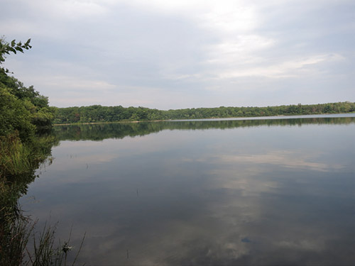
In three-quarters of a mile, you’ll come to a junction with another woods road. Turn left here, staying on the Iris Trail, then bear right at the next fork. In half a mile, you’ll cross a wooden footbridge over the inlet of Lake Rutherford and begin to parallel the lake.
Soon, you’ll pass a rock outcrop on the right with a view of the lake. Then, just before the trail bears left, away from the lake, a side trail on the right leads down to the lake. This is another good spot to take a break and enjoy the views over the scenic lake. Swimming is not permitted, however, since the lake serves as the municipal water supply for the town of Sussex.
After another mile and a half on the Iris Trail, you’ll cross a footbridge over a stream and reach the junction with the blue-blazed trail you followed at the start of the hike. Turn right onto the blue-blazed trail and follow it back to the parking area where the hike began. (If you wish to visit the High Point Monument, turn left onto Route 23 and continue uphill, then take the first right and follow signs to the monument.)
This hiking article is provided by Daniel Chazin of the New York-New Jersey Trail Conference. The Trail Conference is a volunteer organization that builds and maintains over 2,000 miles of hiking trails and publishes a library of hiking maps and books, including a four-map set for Kittatinny Trails ($13.95). The Trail Conference’s office is at 600 Ramapo Valley Road (Route 202), Mahwah. Call 201-512-9348 or visit www.nynjtc.org. Daniel Chazin can be reached at [email protected].